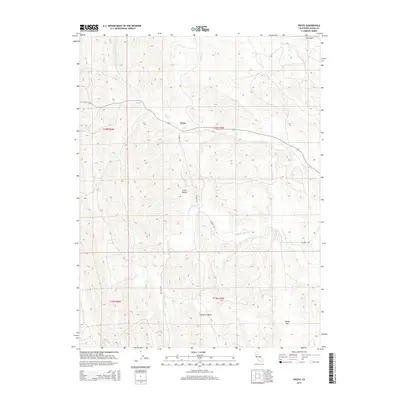
2015 Map of Fruto
USGS Topo · Published 2015About this map
Fruto sits as the primary point of settlement in this northern California landscape, centered where Nye Cr meets the winding path of Co Road 303. The terrain is defined by a series of north-south running ridges and narrow basins, including the distinct Clark Valley and Hubbard Valley. These valleys channel seasonal drainage through systems like S Fork Willow Cr, creating a complex network of canyons and gulches such as Salt Gulch and Hayes Hollow Cr. The 2015 data reflects a sparsely populated area of Glenn County where land use is dictated by the sharp relief of the Inner Coast Range, with most infrastructure limited to county roads and remote survey sections within t20n r5w and t19n r6w. Significant topographic features like Squaw Flat in the southeast provide rare breaks in the otherwise consistent canyon systems of Gopher Cr and Fillippi Cr.
Find a feature on this map
16 named features on this map. Tap any name to fly to it.
Don’t see what you’re looking for? This feature index may not catch every label — zoom into the map to look around manually.
Map Details
Editions of this 2015 Fruto Map
This is the sole edition of this map. No revisions or reprints were ever made.
Other maps of this area

1904 · Walker Creek
USGS Topo · 1:31,680

1904 · Logan Creek
USGS Topo · 1:24,000

1917 · Kurand
USGS Topo · 1:31,680

1918 · Logan Creek
USGS Topo · 1:31,680

1919 · Fruto
USGS Topo · 1:62,500

1919 · Elk Creek
USGS Topo · 1:62,500

1943 · Lodoga
USGS Topo · 1:62,500

1944 · Fruto
USGS Topo · 1:62,500

1948 · Elk Creek
USGS Topo · 1:62,500

1951 · Stonyford
USGS Topo · 1:62,500