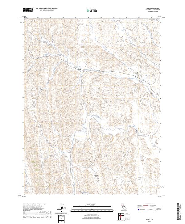
2023 Map of Fruto
USGS Topo · Published 2023About this map
The small settlement of Fruto serves as the focal point of this northern California landscape, situated where Nye Creek and the hills of the Coast Range meet the western edge of the Sacramento Valley. The map documents a terrain defined by seasonal drainages and low valleys, such as Hubbard Valley and Clark Valley, which have long shaped the ranching and agricultural patterns of Glenn County. A significant site for local history is the Nye Pioneer Cem, located near the intersection of the foothills and the plains, marking the enduring presence of early families in the region. The drainage network, including the South Fork Willow Creek and Gopher Creek, illustrates the complex hydrology that supports the livestock and open-range land use visible throughout the quadrangle. Geographic markers like Logan Flat and Central Valley further define the local topography, providing a detailed record of the area's contemporary rural character.
Find a feature on this map
21 named features on this map. Tap any name to fly to it.
Don’t see what you’re looking for? This feature index may not catch every label — zoom into the map to look around manually.
Map Details
Editions of this 2023 Fruto Map
This is the sole edition of this map. No revisions or reprints were ever made.
Other maps of this area

1904 · Walker Creek
USGS Topo · 1:31,680

1904 · Logan Creek
USGS Topo · 1:24,000

1917 · Kurand
USGS Topo · 1:31,680

1918 · Logan Creek
USGS Topo · 1:31,680

1919 · Fruto
USGS Topo · 1:62,500

1919 · Elk Creek
USGS Topo · 1:62,500

1943 · Lodoga
USGS Topo · 1:62,500

1944 · Fruto
USGS Topo · 1:62,500

1948 · Elk Creek
USGS Topo · 1:62,500

1951 · Stonyford
USGS Topo · 1:62,500