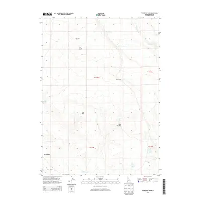
2013 Map of Frying Pan Basin
USGS Topo · Published 2013About this map
Dickshooter and Squaw Meadows anchor this 2013 topographic study of the high Owyhee desert. The map details a landscape defined by critical water sources for ranching and wildlife, such as Avandale Spring and Frying Pan Spring, alongside numerous reservoirs including South Bend Res and Rim Rock Res. The topographic relief is marked by the eponymous Frying Pan Basin and the prominent Big Springs Butte, which rises above the surrounding plateaus and gulches.
Find a feature on this map
21 named features on this map. Tap any name to fly to it.
Don’t see what you’re looking for? This feature index may not catch every label — zoom into the map to look around manually.
Map Details
Editions of this 2013 Frying Pan Basin Map
This is the sole edition of this map. No revisions or reprints were ever made.
Other maps of this area

1955 · Jordan Valley
USGS Topo · 1:250,000

1957 · Jordan Valley
USGS Topo · 1:250,000

1958 · Jordan Valley
USGS Topo · 1:250,000
1972 · Frying Pan Basin
USGS Topo · 1:24,000
1972 · Big Springs Ranch
USGS Topo · 1:24,000
1972 · Crab Spring Butte
USGS Topo · 1:24,000
1972 · Shoofly Springs
USGS Topo · 1:24,000
1972 · Battle Creek Lakes
USGS Topo · 1:24,000
1972 · Lost Valley
USGS Topo · 1:24,000
1973 · Wagon Box Basin
USGS Topo · 1:24,000