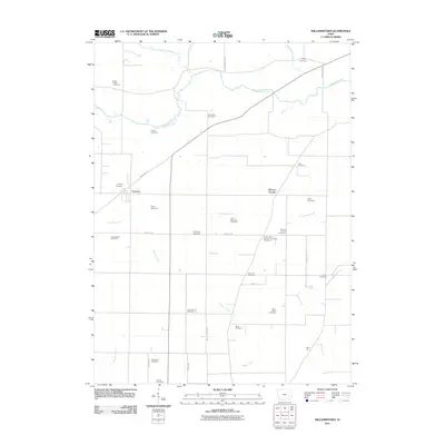
2011 Map of Frytown
USGS Topo · Published 2011About this map
Saint Peters Cemetery and Unity Cemetery anchor the northern landscape of this rural Johnson County tract, where the wandering path of Old Mans Creek and its tributary, the North Branch Old Mans Creek, define the drainage of the local prairie. The map reveals a high concentration of small family and community burial grounds, including the Hochstetler Cemetery, John Helmuth Cemetery, and Peter Miller Cemetery, which suggest a deeply rooted agricultural history and ancestral settlement patterns.
Find a feature on this map
38 named features on this map. Tap any name to fly to it.
Don’t see what you’re looking for? This feature index may not catch every label — zoom into the map to look around manually.
Map Details
Editions of this 2011 Frytown Map
This is the sole edition of this map. No revisions or reprints were ever made.
Other maps of this area

1891 · Oxford
USGS Topo · 1:62,500

1891 · Iowa City
USGS Topo · 1:62,500

1894 · Oxford
USGS Topo · 1:62,500

1903 · Fairfax
USGS Topo · 1:125,000

1938 · Iowa City
USGS Topo · 1:62,500

1958 · Davenport
USGS Topo · 1:250,000

1961 · Davenport
USGS Topo · 1:250,000

1962 · Davenport
USGS Topo · 1:250,000

1965 · Williamstown
USGS Topo · 1:24,000
1965 · Tiffin
USGS Topo · 1:24,000