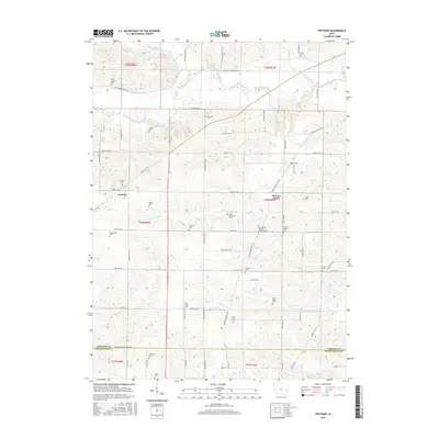
2015 Map of Frytown
USGS Topo · Published 2015About this map
The agrarian borderland of Johnson and Washington Counties is defined by a dense concentration of family and community burial grounds, reflecting the deep roots of the local heritage. Settlements like Frytown and Sharon Center anchor the township grid, which is woven with numerous small cemeteries such as John Helmuth Cem, Gingerich Cem, and Hochstetler Cem. These sites, often named for the area's early families, provide a rich map for genealogists tracing ancestral homesteads near the banks of Old Mans Creek or the meandering Picayune Cr.
Find a feature on this map
49 named features on this map. Tap any name to fly to it.
Don’t see what you’re looking for? This feature index may not catch every label — zoom into the map to look around manually.
Map Details
Editions of this 2015 Frytown Map
This is the sole edition of this map. No revisions or reprints were ever made.
Other maps of this area

1891 · Oxford
USGS Topo · 1:62,500

1891 · Iowa City
USGS Topo · 1:62,500

1894 · Oxford
USGS Topo · 1:62,500

1903 · Fairfax
USGS Topo · 1:125,000

1938 · Iowa City
USGS Topo · 1:62,500

1958 · Davenport
USGS Topo · 1:250,000

1961 · Davenport
USGS Topo · 1:250,000

1962 · Davenport
USGS Topo · 1:250,000

1965 · Williamstown
USGS Topo · 1:24,000
1965 · Tiffin
USGS Topo · 1:24,000