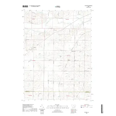
2018 Map of Frytown
USGS Topo · Published 2018About this map
Frytown and Sharon Center anchor this agricultural landscape in southeastern Johnson County, where the terrain is defined by the winding paths of Old Mans Creek and Dirty Face Cr. The map reveals a high density of small family and community burial grounds, such as John Helmuth Cem, Yoder Cem, and the Hochstetler Cem, which provide significant genealogical clues for the area’s early settler families. The section lines and grid-road system, including Black Diamond Rd SW and Sharon Center Rd SW, dictate the placement of farmsteads across the undulating ridges of Redwing Hollow SW and Kestrel Ridge SW. To the south, the boundary between Johnson and Washington counties crosses through the watershed of Picayune Cr and Bulgers Run, maintaining the rural character of the borderlands near the historic Snider Cem.
Find a feature on this map
66 named features on this map. Tap any name to fly to it.
Don’t see what you’re looking for? This feature index may not catch every label — zoom into the map to look around manually.
Map Details
Editions of this 2018 Frytown Map
This is the sole edition of this map. No revisions or reprints were ever made.
Other maps of this area

1891 · Oxford
USGS Topo · 1:62,500

1891 · Iowa City
USGS Topo · 1:62,500

1894 · Oxford
USGS Topo · 1:62,500

1903 · Fairfax
USGS Topo · 1:125,000

1938 · Iowa City
USGS Topo · 1:62,500

1958 · Davenport
USGS Topo · 1:250,000

1961 · Davenport
USGS Topo · 1:250,000

1962 · Davenport
USGS Topo · 1:250,000

1965 · Williamstown
USGS Topo · 1:24,000
1965 · Tiffin
USGS Topo · 1:24,000