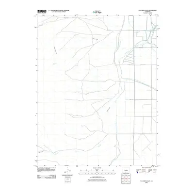
2010 Map of Fulcher Gulch
USGS Topo · Published 2010About this map
The intricate irrigation network of the San Luis Valley is on display in this 2010 topographic survey, where a complex system of canals and ditches redirects water across the semi-arid landscape. Engineering feats like the Monte Vista Canal and the Rio Grande and Piedra Valley Canal dominate the eastern half of the map, illustrating the region's total reliance on managed water for agriculture. Smaller, local-scale waterworks such as the Sheridan North Ditch, Resettlement Ditch, and Meadow Ditch indicate the historical division of water rights among specific land parcels and farmsteads. To the west, the terrain rises into the foothills, marked by deep drainages like Goat Ranch Gulch, Fulcher Gulch, and the prominent The Canyon. These natural features, along with Goat Ranch Spring, contrast with the rigid north-south and east-west orientation of the modern road grid, which includes S County Rd 1 E and Tenmile Rd S.
Find a feature on this map
25 named features on this map. Tap any name to fly to it.
Don’t see what you’re looking for? This feature index may not catch every label — zoom into the map to look around manually.
Map Details
Editions of this 2010 Fulcher Gulch Map
This is the sole edition of this map. No revisions or reprints were ever made.
Other maps of this area

1915 · Del Norte
USGS Topo · 1:125,000

1917 · Del Norte
USGS Topo · 1:125,000

1922 · Conejos
USGS Topo · 1:125,000

1945 · Durango
USGS Topo · 1:250,000

1953 · Durango
USGS Topo · 1:250,000

1954 · Durango
USGS Topo · 1:250,000

1961 · Durango
USGS Topo · 1:250,000

1963 · Durango
USGS Topo · 1:250,000

1964 · Monte Vista
USGS Topo · 1:24,000

1966 · Durango
USGS Topo · 1:250,000