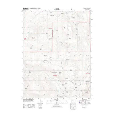
2013 Map of Fulford
USGS Topo · Published 2013About this map
Fulford sits at the heart of this high-altitude landscape, serving as a primary point of human settlement within the expansive White River National Forest. The geography is defined by significant peaks such as Bellyache Mountain and Adam Mountain, alongside complex drainage systems like Nolan Creek and Salt Creek. The map documents a rich history of extraction and mountain access, evidenced by the New York Mountain Mine and numerous named prospects and shafts. Water management is a visible priority, with features like Bemis Ditch and Graham Ditch cutting across the terrain to redirect flow from high springs like Happy Jack Spring and Elk Spring.
Find a feature on this map
84 named features on this map. Tap any name to fly to it.
Don’t see what you’re looking for? This feature index may not catch every label — zoom into the map to look around manually.
Map Details
Editions of this 2013 Fulford Map
This is the sole edition of this map. No revisions or reprints were ever made.
Other maps of this area

1909 · Mount Jackson
USGS Topo · 1:125,000

1911 · Mount Jackson
USGS Topo · 1:125,000

1957 · Leadville
USGS Topo · 1:250,000

1959 · Leadville
USGS Topo · 1:250,000

1960 · Leadville
USGS Topo · 1:250,000

1961 · Red Creek
USGS Topo · 1:24,000

1962 · Leadville
USGS Topo · 1:250,000

1962 · Grouse Mountain
USGS Topo · 1:24,000

1962 · Fulford
USGS Topo · 1:24,000

1962 · Wolcott
USGS Topo · 1:24,000