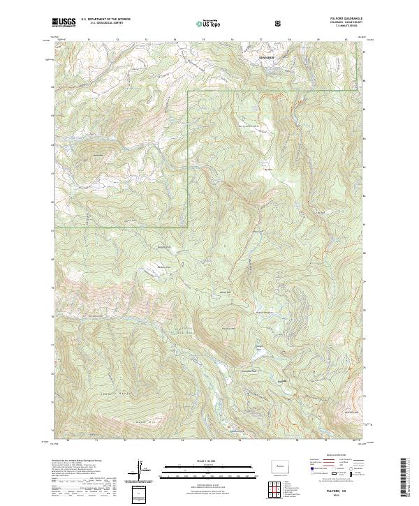
2023 Map of Fulford
USGS Topo · Published 2023About this map
Fulford stands as the primary historic anchor in this high-altitude landscape, situated among the steep drainages of the White River National Forest. The map captures a transition from the developing residential reaches of Edwards in the north to the protected peaks of the Holy Cross Wilderness in the south. The terrain is defined by a dense network of gulches and ridges, including Bellyache Ridge and New York Mountain, which rises above the mining-era namesake of White Quail Gulch.
Find a feature on this map
95 named features on this map. Tap any name to fly to it.
Don’t see what you’re looking for? This feature index may not catch every label — zoom into the map to look around manually.
Map Details
Editions of this 2023 Fulford Map
This is the sole edition of this map. No revisions or reprints were ever made.
Other maps of this area

1909 · Mount Jackson
USGS Topo · 1:125,000

1911 · Mount Jackson
USGS Topo · 1:125,000

1957 · Leadville
USGS Topo · 1:250,000

1959 · Leadville
USGS Topo · 1:250,000

1960 · Leadville
USGS Topo · 1:250,000

1961 · Red Creek
USGS Topo · 1:24,000

1962 · Leadville
USGS Topo · 1:250,000

1962 · Grouse Mountain
USGS Topo · 1:24,000

1962 · Fulford
USGS Topo · 1:24,000

1962 · Wolcott
USGS Topo · 1:24,000