
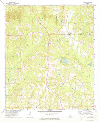
1971 Map of Fullers Crossroads
USGS Topo · Published 1973About this map
Fullers Crossroads serves as a central hub in this rural Crenshaw County landscape, where the agricultural character of the early 1970s is evident in the network of country roads and scattered settlements. Small communities like Centenary and Live Oak are anchored by local landmarks such as Mt Pleasant Ch and Longs Chapel. The terrain is defined by the winding course of Little Patsaliga Creek and Pond Creek, with numerous smaller tributaries like Briar Branch and Huckleberry Branch carving through the wooded hills.
Find a feature on this map
35 named features on this map. Tap any name to fly to it.
Don’t see what you’re looking for? This feature index may not catch every label — zoom into the map to look around manually.
Map Details
Editions of this 1971 Fullers Crossroads Map
This is the sole edition of this map. No revisions or reprints were ever made.
Other maps of this area

1953 · Andalusia
USGS Topo · 1:250,000

1957 · Andalusia
USGS Topo · 1:250,000

1968 · Glenwood
USGS Topo · 1:24,000

1968 · Petrey
USGS Topo · 1:24,000

1968 · Grady
USGS Topo · 1:24,000

1971 · Luverne
USGS Topo · 1:24,000

1971 · Honoraville
USGS Topo · 1:24,000

1971 · Moodys Crossroads
USGS Topo · 1:24,000

1971 · Danielsville
USGS Topo · 1:24,000
1971 · Lapine
USGS Topo · 1:24,000