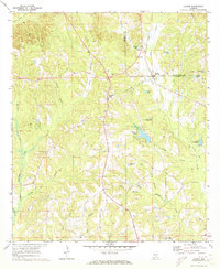
1971 Map of Lapine
USGS Topo · Published 1979About this map
Lapine and Highland Home anchor this rural landscape along the boundary of Montgomery and Crenshaw counties. Surveyed in the early 1970s, the terrain is defined by a dense network of waterways feeding into Patsaliga Creek and Pintlalla Creek. The map documents a scattered settlement pattern characterized by small community centers like Sardis and Saville, alongside spiritual and family landmarks such as Rocky Mount Cem and New Ebenezer Ch.
Find a feature on this map
36 named features on this map. Tap any name to fly to it.
Don’t see what you’re looking for? This feature index may not catch every label — zoom into the map to look around manually.
Map Details
Editions of this 1971 Lapine Map
2 editions found
Other maps of this area

1953 · Montgomery
USGS Topo · 1:250,000

1953 · Andalusia
USGS Topo · 1:250,000

1956 · Montgomery
USGS Topo · 1:250,000

1957 · Montgomery
USGS Topo · 1:250,000

1957 · Andalusia
USGS Topo · 1:250,000

1957 · Letohatchee
USGS Topo · 1:62,500

1968 · Petrey
USGS Topo · 1:24,000

1968 · Grady
USGS Topo · 1:24,000

1971 · Fullers Crossroads
USGS Topo · 1:24,000

1971 · Honoraville
USGS Topo · 1:24,000