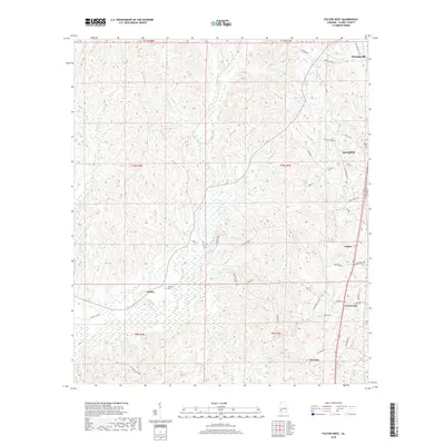
2018 Map of Fulton West
USGS Topo · Published 2018About this map
Thomasville and the timber-rich landscape of northern Clarke County dominate this geographic study. The terrain is defined by a dense network of drainages including Salitpa Cr and Patsaliga Cr, which carve through the elevations near small established communities like Springfield, Fulton, and Chilton. The map documents a rural economy where land is often identified by water features and family-named roads, such as Uncle Ben Rd and Kelley Rd.
Find a feature on this map
50 named features on this map. Tap any name to fly to it.
Don’t see what you’re looking for? This feature index may not catch every label — zoom into the map to look around manually.
Map Details
Editions of this 2018 Fulton West Map
This is the sole edition of this map. No revisions or reprints were ever made.
Other maps of this area

1953 · Andalusia
USGS Topo · 1:250,000

1957 · Andalusia
USGS Topo · 1:250,000

1972 · Whatley
USGS Topo · 1:24,000

1973 · Fulton East
USGS Topo · 1:24,000

1973 · Thomasville
USGS Topo · 1:24,000

1978 · McEntyre
USGS Topo · 1:24,000
1978 · Bashi
USGS Topo · 1:24,000

1978 · Winn
USGS Topo · 1:24,000
1978 · Morvin
USGS Topo · 1:24,000
1978 · Grove Hill
USGS Topo · 1:24,000