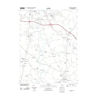
2011 Map of Funkstown
USGS Topo · Published 2011About this map
Funkstown occupies the north-central portion of this Washington County landscape, where the waters of Antietam Creek wind past the Funkstown Public Cemetery and the local post office. The area is defined by a dense network of suburban developments like Woodcrest Village, Edgewood Hill, and Brightwood Acres, interspersed with institutional landmarks and agricultural operations. To the south, the Roxbury Correctional Institute stands near the geological feature known as Devils Backbone, while the University of Maryland Experimental Farm and Misty Mount Girl Scout Camp highlight the diverse land use of the mid-2010s. The eastern reaches include the A M Powell State Fish Hatchery and the Mason-Dixon Dragway, illustrating the mix of state conservation and regional recreation. Small historical nodes like Breathedsville, Lappans, and Tilghmanton continue to anchor the rural road intersections between these growing residential clusters.
Find a feature on this map
143 named features on this map. Tap any name to fly to it.
Don’t see what you’re looking for? This feature index may not catch every label — zoom into the map to look around manually.
Map Details
Editions of this 2011 Funkstown Map
This is the sole edition of this map. No revisions or reprints were ever made.
Other maps of this area

1884 · Harpers Ferry
USGS Topo · 1:125,000

1891 · Harpers Ferry
USGS Topo · 1:125,000

1893 · Harpers Ferry
USGS Topo · 1:125,000

1908 · Middletown
USGS Topo · 1:48,000

1909 · Hagerstown
USGS Topo · 1:48,000

1910 · Antietam
USGS Topo · 1:62,500

1912 · Hagerstown
USGS Topo · 1:62,500

1912 · Williamsport
USGS Topo · 1:62,500

1914 · Martinsburg
USGS Topo · 1:48,000

1916 · Martinsburg
USGS Topo · 1:62,500