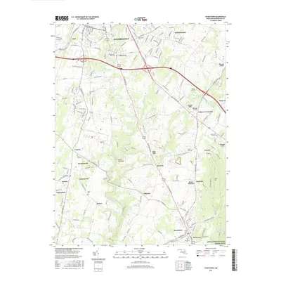
2017 Map of Funkstown
USGS Topo · Published 2017About this map
Antietam Creek meanders through the heart of Washington County, anchoring a landscape where modern infrastructure meets 18th and 19th-century history. The waterway passes notable landmarks like the geologic formation at Devils Backbone and several historic industrial sites, including Kline Mill and Doubs Mill. These mills, along with crossroads settlements like Benevola and Breathedsville, reflect the area's deep-rooted agricultural and milling heritage. In the southeast, the terrain shifts significantly as the Appalachian National Scenic Trail traverses the slopes of Short Hill near the town of Boonsboro. Genealogists will find a high density of burial grounds throughout the quadrangle, ranging from the Mount Lena Graveyard to the Manor Cem and the Funkstown Public Cem. The map illustrates how late 20th-century expansion from Hagerstown and Robinwood integrates with established communities like Lappans and Mapleville.
Find a feature on this map
181 named features on this map. Tap any name to fly to it.
Don’t see what you’re looking for? This feature index may not catch every label — zoom into the map to look around manually.
Map Details
Editions of this 2017 Funkstown Map
This is the sole edition of this map. No revisions or reprints were ever made.
Other maps of this area

1884 · Harpers Ferry
USGS Topo · 1:125,000

1891 · Harpers Ferry
USGS Topo · 1:125,000

1893 · Harpers Ferry
USGS Topo · 1:125,000

1908 · Middletown
USGS Topo · 1:48,000

1909 · Hagerstown
USGS Topo · 1:48,000

1910 · Antietam
USGS Topo · 1:62,500

1912 · Hagerstown
USGS Topo · 1:62,500

1912 · Williamsport
USGS Topo · 1:62,500

1914 · Martinsburg
USGS Topo · 1:48,000

1916 · Martinsburg
USGS Topo · 1:62,500