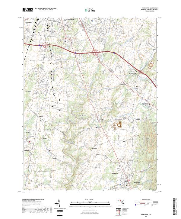
2023 Map of Funkstown
USGS Topo · Published 2023About this map
Antietam Creek meanders through the heart of Washington County, anchoring a landscape shaped by early milling and rural settlement patterns. This modern topographic study reveals the persistent footprints of 19th-century industry, featuring sites such as Doubs Mill and Kline Mill along the network of limestone-fed streams. The region is characterized by a dense concentration of early burying grounds and family-named crossroads, including Wagners Crossroads and Breathedsville, which speak to the area's deep-rooted agricultural heritage. To the south, the community of Boonsboro serves as a focal point, situated near the Boonsboro Reservoir and the base of Short Hill. The map also captures the geological prominence of the Devils Backbone, a distinctive rock formation along the creek that has influenced local transit and land use for generations.
Find a feature on this map
198 named features on this map. Tap any name to fly to it.
Don’t see what you’re looking for? This feature index may not catch every label — zoom into the map to look around manually.
Map Details
Editions of this 2023 Funkstown Map
This is the sole edition of this map. No revisions or reprints were ever made.
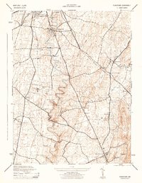
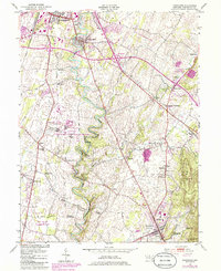
Historical Maps of Antietam Farmettes Through Time
3 maps found