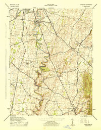
1944 Map of Funkstown
USGS Topo · Published 1944About this map
Antietam Creek carves a winding path through this mid-century Washington County landscape, anchoring a network of small settlements and agricultural sites. The map reveals the industrial and institutional character of the era, from the milling heritage at Rose Mill and Kline Bros Mill to the prominent Maryland State Penal Farm near Roxbury. Transportation infrastructure is highly visible, featuring the tracks of the Norfolk and Western and Baltimore and Ohio railroads connecting stops like Vardo Sta and Breatheds Sta. Local genealogists can trace family names through landmarks like Wagners Crossroads and Sharman (Showman Sta), while the rural economy is marked by localized hubs like the Whitehouse Store. The survey also highlights smaller crossroads such as Lappans (Breathedsville P O) and Mapleville, providing a detailed view of the county's social geography during the war years.
Find a feature on this map
41 named features on this map. Tap any name to fly to it.
Don’t see what you’re looking for? This feature index may not catch every label — zoom into the map to look around manually.
Map Details
Editions of this 1944 Funkstown Map
2 editions found
Other maps of this area

1884 · Harpers Ferry
USGS Topo · 1:125,000

1891 · Harpers Ferry
USGS Topo · 1:125,000

1893 · Harpers Ferry
USGS Topo · 1:125,000

1908 · Middletown
USGS Topo · 1:48,000

1909 · Hagerstown
USGS Topo · 1:48,000

1910 · Antietam
USGS Topo · 1:62,500

1912 · Hagerstown
USGS Topo · 1:62,500

1912 · Williamsport
USGS Topo · 1:62,500

1914 · Martinsburg
USGS Topo · 1:48,000

1916 · Martinsburg
USGS Topo · 1:62,500