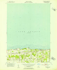
1952 Map of Furnaceville
USGS Topo · Published 1953About this map
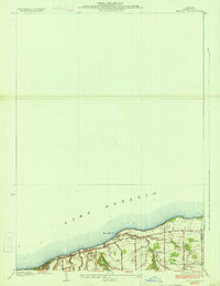
Lake Ontario dominates the northern half of this 1950s survey, with bathymetric contours marking the shelf as it drops away from Smoky Point. Along the shoreline, the community of Ontario On the Lake sits west of Bear Creek Harbor, illustrating the seasonal and residential development typical of the Wayne County coast during this era. Further inland, the landscape is defined by a network of rural roads such as Brick Church Road and Slocum Road, which connect small clusters of activity like Lakeside and the southern hamlet of Furnaceville. Local history is rooted in sites like Lakeside Cem, Centenary Ch, and School No 13, which reflect the established social infrastructure of a township transitioning between its agricultural past and a growing identity as a lakeside retreat.
Find a feature on this map
20 named features on this map. Tap any name to fly to it.
Don’t see what you’re looking for? This feature index may not catch every label — zoom into the map to look around manually.
Map Details
Editions of this 1952 Furnaceville Map
4 editions found
Other maps of this area

1899 · Palmyra
USGS Topo · 1:62,500

1900 · Macedon
USGS Topo · 1:62,500

1902 · Pultneyville
USGS Topo · 1:62,500

1902 · Palmyra
USGS Topo · 1:62,500

1932 · Webster
USGS Topo · 1:24,000
1934 · Ninemile Point
USGS Topo · 1:24,000

1934 · Webster
USGS Topo · 1:24,000

1942 · Ontario
USGS Topo · 1:31,680

1942 · Pultneyville
USGS Topo · 1:31,680

1943 · Williamson
USGS Topo · 1:31,680