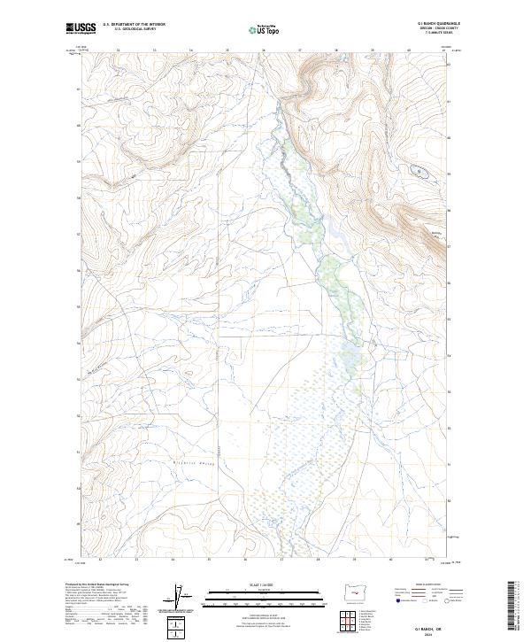
2024 Map of G I Ranch
USGS Topo · Published 2024About this map
The South Fork Crooked River meanders through this high-desert landscape, defining the hydrology of the eastern Oregon interior. Its course is marked by the Logan Reservoir, which captures seasonal flows in an area where water management is central to the local environment. To the east, the elevation rises sharply toward Rodman Rim, a significant topographic break that borders the flatter expanse of the Gilchrist Valley to the south. This region is characterized by a network of isolated routes including Price-Twelvemile Rd and S E G I Rd, which navigate the drainage patterns of New Canyon. The map reveals a land structured by the Public Land Survey System, where section lines and range boundaries dictate the layout of these remote corridors and water resources.
Find a feature on this map
13 named features on this map. Tap any name to fly to it.
Don’t see what you’re looking for? This feature index may not catch every label — zoom into the map to look around manually.
Map Details
Editions of this 2024 G I Ranch Map
This is the sole edition of this map. No revisions or reprints were ever made.
Other maps of this area

1955 · Crescent
USGS Topo · 1:250,000

1955 · Burns
USGS Topo · 1:250,000

1957 · Crescent
USGS Topo · 1:250,000

1958 · Crescent
USGS Topo · 1:250,000

1958 · Burns
USGS Topo · 1:250,000

1959 · Burns
USGS Topo · 1:250,000

1970 · Crescent
USGS Topo · 1:250,000
1981 · Hardin Ranch
USGS Topo · 1:24,000
1981 · Dust Bowl
USGS Topo · 1:24,000
1981 · Ibex Butte
USGS Topo · 1:24,000