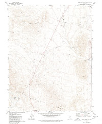
1979 Map of Gabbs Mountain
USGS Topo · Published 1980About this map
Gabbs Mountain dominates the northwestern portion of this high-desert landscape in Mineral County, where the terrain transitions into the Gabbs Valley Range. Surveyed in the mid-1970s, the map reveals a remote environment defined by ephemeral drainages like Petrified Wash and Finger Rock Wash. The presence of Stinson Well and Petrified Spring suggests the critical importance of water sources for travel and ranching in this arid region of Nevada.
Find a feature on this map
13 named features on this map. Tap any name to fly to it.
Don’t see what you’re looking for? This feature index may not catch every label — zoom into the map to look around manually.
Map Details
Editions of this 1979 Gabbs Mountain Map
This is the sole edition of this map. No revisions or reprints were ever made.
Other maps of this area

1907 · Tonopah
USGS Topo · 1:250,000

1908 · Tonopah
USGS Topo · 1:250,000

1909 · Hawthorne
USGS Topo · 1:250,000

1911 · Hawthorne
USGS Topo · 1:250,000

1915 · Hawthorne
USGS Topo · 1:250,000

1948 · Paradise Peak
USGS Topo · 1:62,500

1948 · Walker Lake
USGS Topo · 1:250,000

1950 · Paradise Peak
USGS Topo · 1:62,500

1956 · Tonopah
USGS Topo · 1:250,000

1957 · Walker Lake
USGS Topo · 1:250,000