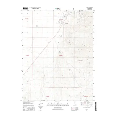
2014 Map of Gabbs
USGS Topo · Published 2014About this map
The high-desert mining town of Gabbs sits at the base of the Paradise Range in this Nevada survey. The settlement's layout reflects its industrial origins, with residential streets like Brucite St and Basic Ave giving way to the surrounding resource-rich landscape. To the east, the rugged foothills lead into the Toiyabe National Forest, marked by steep elevations and several named drainage points including Cottonwood Canyon and Tungsten Canyon. To the west, the terrain flattens into the expansive Gabbs Valley. The map also captures several outlying points of interest, such as the small settlements of Brucite and Basic, and critical water sources in an arid climate like Peppercorn Spring and Willow Spring. The presence of Power Line Rd indicates the infrastructure required to support the local mineral extraction and community needs within this remote part of Nye County.
Find a feature on this map
30 named features on this map. Tap any name to fly to it.
Don’t see what you’re looking for? This feature index may not catch every label — zoom into the map to look around manually.
Map Details
Editions of this 2014 Gabbs Map
This is the sole edition of this map. No revisions or reprints were ever made.
Other maps of this area

1907 · Tonopah
USGS Topo · 1:250,000

1908 · Tonopah
USGS Topo · 1:250,000

1909 · Hawthorne
USGS Topo · 1:250,000

1911 · Hawthorne
USGS Topo · 1:250,000

1915 · Hawthorne
USGS Topo · 1:250,000

1948 · Paradise Peak
USGS Topo · 1:62,500

1948 · Walker Lake
USGS Topo · 1:250,000

1950 · Paradise Peak
USGS Topo · 1:62,500

1956 · Tonopah
USGS Topo · 1:250,000

1957 · Walker Lake
USGS Topo · 1:250,000