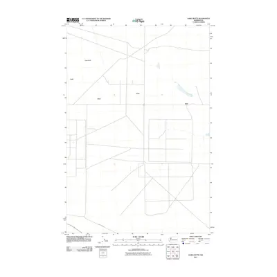
2011 Map of Gable Butte
USGS Topo · Published 2011About this map
Gable Butte rises above the arid landscape of Benton County, serving as a prominent geographical anchor for this section of central Washington. The 2011 survey reveals an intriguing pattern of localized names including Susie, Ethel, Pearl, and Willa, which stand as scattered markers across an otherwise sparse and open territory. These names appear in a region heavily shaped by government activity, connected by infrastructure such as Army Loop Rd. The map illustrates the structured, modern grid system of the area, punctuated by small reservoirs and specialized facility sites that suggest a landscape managed for specific technical or defensive purposes rather than traditional dense urban development. This cartographic study preserves the unique nomenclature of the high desert before further changes in the 21st century.
Find a feature on this map
6 named features on this map. Tap any name to fly to it.
Don’t see what you’re looking for? This feature index may not catch every label — zoom into the map to look around manually.
Map Details
Editions of this 2011 Gable Butte Map
This is the sole edition of this map. No revisions or reprints were ever made.
Other maps of this area

1915 · Prosser
USGS Topo · 1:125,000

1916 · Coyote Rapids
USGS Topo · 1:62,500

1917 · Pasco
USGS Topo · 1:125,000

1917 · Prosser
USGS Topo · 1:125,000

1924 · Hanford
USGS Topo · 1:62,500

1951 · Richland
USGS Topo · 1:62,500

1951 · Hanford
USGS Topo · 1:62,500

1951 · Corral Canyon
USGS Topo · 1:62,500

1951 · Coyote Rapids
USGS Topo · 1:62,500

1953 · Walla Walla
USGS Topo · 1:250,000