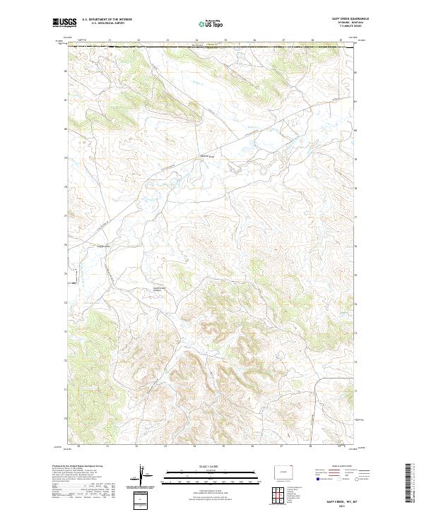
2021 Map of Gaff Creek
USGS Topo · Published 2021About this map
The Little Missouri River carves through the high plains of the Wyoming Crook County and Montana Carter County border, anchoring a landscape of intermittent drainages and named coulees. This 2021 survey reveals a remote ranching and grazing environment defined by expansive drainage systems like Sawmill Draw and Scoggin Draw. Settlement is sparse, represented by isolated ranch access via Little Missouri Rd and Government Canyon Rd. Water management is central to the land's utility, evidenced by the presence of the H L Reservoir and the network of seasonal creeks including Gaff Cr and Holben Cr. The map provides a clear look at the Public Land Survey System grid, which dictates the layout of modern county roads like Co Rd 200 and N Alzada Rd across the state line.
Find a feature on this map
25 named features on this map. Tap any name to fly to it.
Don’t see what you’re looking for? This feature index may not catch every label — zoom into the map to look around manually.
Map Details
Editions of this 2021 Gaff Creek Map
This is the sole edition of this map. No revisions or reprints were ever made.
Other maps of this area

1901 · Aladdin
USGS Topo · 1:125,000

1903 · Aladdin
USGS Topo · 1:125,000

1905 · Devils Tower
USGS Topo · 1:125,000

1954 · Strawberry Hill
USGS Topo · 1:24,000

1954 · Ekalaka
USGS Topo · 1:250,000

1954 · Gillette
USGS Topo · 1:250,000

1955 · Gillette
USGS Topo · 1:250,000

1956 · Ekalaka
USGS Topo · 1:250,000

1957 · Mona
USGS Topo · 1:62,500

1957 · Seely
USGS Topo · 1:62,500