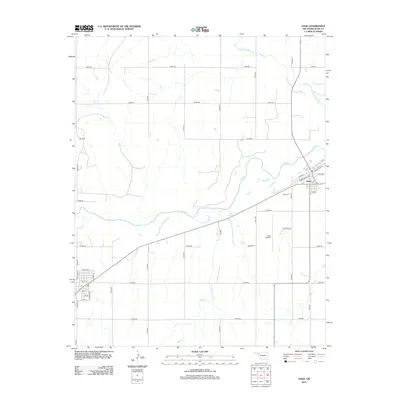
2012 Map of Gage
USGS Topo · Published 2012About this map
Gage stands as the primary hub of this High Plains landscape, situated at the confluence of transport and hydrology in Ellis County. The town grid is defined by streets like Santa Fe St and W Cedar, reflecting its orientation toward the railroad corridor that cuts diagonally through the territory. To the southwest of the main settlement, the Gage Cem and the sprawling Gage Airport mark the transition from town life to the expansive rangeland.
Find a feature on this map
38 named features on this map. Tap any name to fly to it.
Don’t see what you’re looking for? This feature index may not catch every label — zoom into the map to look around manually.
Map Details
Editions of this 2012 Gage Map
This is the sole edition of this map. No revisions or reprints were ever made.
Other maps of this area

1955 · Woodward
USGS Topo · 1:250,000

1958 · Woodward
USGS Topo · 1:250,000

1969 · Fargo SW
USGS Topo · 1:24,000

1969 · Fargo NW
USGS Topo · 1:24,000

1969 · Shattuck
USGS Topo · 1:24,000

1969 · Shattuck NW
USGS Topo · 1:24,000

1969 · Gage
USGS Topo · 1:24,000

1969 · Shattuck NE
USGS Topo · 1:24,000

1970 · Arnett
USGS Topo · 1:24,000

1970 · Goodwin
USGS Topo · 1:24,000