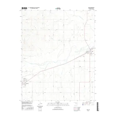
2016 Map of Gage
USGS Topo · Published 2016About this map
Gage and Shattuck anchor the landscape of Ellis County in this western Oklahoma survey. The terrain is defined by the winding course of Wolf Cr, which flows eastward between the two primary settlements, flanked by seasonal drainage through Willow Cr and Twentyfive Mile Cr. The map captures the infrastructure of the High Plains, where the grid-like county road system intersects with the Santa Fe rail lines passing through the center of Gage. Genealogists and local researchers will find the location of Gage Cem and the Gage Airport clearly marked, offering a precise look at the community's layout and essential landmarks during the mid-2010s.
Find a feature on this map
54 named features on this map. Tap any name to fly to it.
Don’t see what you’re looking for? This feature index may not catch every label — zoom into the map to look around manually.
Map Details
Editions of this 2016 Gage Map
This is the sole edition of this map. No revisions or reprints were ever made.
Other maps of this area

1955 · Woodward
USGS Topo · 1:250,000

1958 · Woodward
USGS Topo · 1:250,000

1969 · Fargo SW
USGS Topo · 1:24,000

1969 · Fargo NW
USGS Topo · 1:24,000

1969 · Shattuck
USGS Topo · 1:24,000

1969 · Shattuck NW
USGS Topo · 1:24,000

1969 · Gage
USGS Topo · 1:24,000

1969 · Shattuck NE
USGS Topo · 1:24,000

1970 · Arnett
USGS Topo · 1:24,000

1970 · Goodwin
USGS Topo · 1:24,000