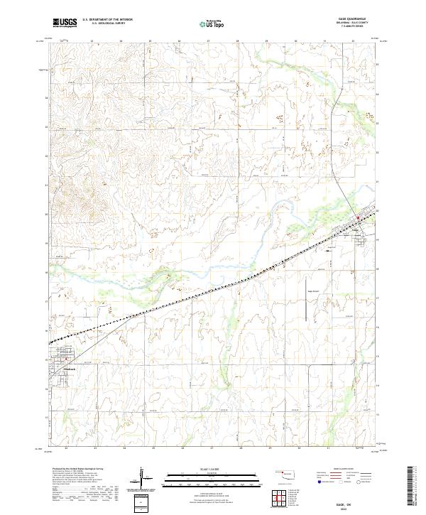
2022 Map of Gage
USGS Topo · Published 2022About this map
Wolf Creek meanders eastward across this portion of Ellis County, serving as a primary drainage corridor for the high plains of western Oklahoma. The settlement of Gage sits along the northern rail line, defined by a grid of streets including W Santa Fe Street and W Cedar Street. To the southwest, the edge of Shattuck is visible, showing a residential layout that includes Carey Avenue and E Oklahoma Avenue. This area represents a classic rural transportation landscape where the paths of the railroad and highway parallel the natural flow of the creek. Landmarks such as the Gage Airport and Gage Cemetery are positioned between the two towns, while smaller tributaries like Twentyfive Mile Creek and Willow Creek draw water from the surrounding section lands.
Find a feature on this map
37 named features on this map. Tap any name to fly to it.
Don’t see what you’re looking for? This feature index may not catch every label — zoom into the map to look around manually.
Map Details
Editions of this 2022 Gage Map
This is the sole edition of this map. No revisions or reprints were ever made.
Other maps of this area

1955 · Woodward
USGS Topo · 1:250,000

1958 · Woodward
USGS Topo · 1:250,000

1969 · Fargo SW
USGS Topo · 1:24,000

1969 · Fargo NW
USGS Topo · 1:24,000

1969 · Shattuck
USGS Topo · 1:24,000

1969 · Shattuck NW
USGS Topo · 1:24,000

1969 · Gage
USGS Topo · 1:24,000

1969 · Shattuck NE
USGS Topo · 1:24,000

1970 · Arnett
USGS Topo · 1:24,000

1970 · Goodwin
USGS Topo · 1:24,000