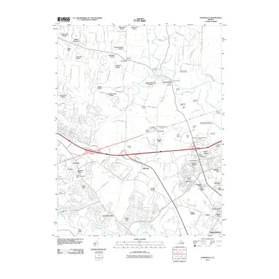
2010 Map of Gainesville
USGS Topo · Published 2010About this map
Stepney Plantation and the historic crossroads of Catharpin anchor the northern reaches of this landscape, where the rural past of Prince William County meets modern suburban expansion. The terrain is marked by significant historical geography, particularly around Groveton, which contains the Groveton Confederate Cemetery and Stonewall Memory Gardens. This area is defined by its complex network of ridges and hills, such as Henry Hill, Matthews Hill, and Chinn Ridge, which rise above the many branches of Bull Run and Youngs Branch. In the south, the expansion of Gainesville and New Market is evident, situated near the industrial and transport corridor of the Norfolk Southern railroad. The map records several smaller family landmarks, including the Taliaferro/Carter Family Cemetery and the Ball Family Cemetery, providing valuable data for genealogists tracing local families in the shadow of the Culpeper Basin.
Find a feature on this map
126 named features on this map. Tap any name to fly to it.
Don’t see what you’re looking for? This feature index may not catch every label — zoom into the map to look around manually.
Map Details
Editions of this 2010 Gainesville Map
This is the sole edition of this map. No revisions or reprints were ever made.
Other maps of this area

1890 · Mt. Vernon
USGS Topo · 1:125,000

1891 · Mt. Vernon
USGS Topo · 1:125,000

1894 · Warrenton
USGS Topo · 1:125,000

1894 · Mt. Vernon
USGS Topo · 1:125,000

1897 · Mt. Vernon
USGS Topo · 1:125,000

1915 · Fairfax
USGS Topo · 1:62,500

1927 · Quantico
USGS Topo · 1:62,500

1933 · Middleburg
USGS Topo · 1:62,500

1940 · Quantico
USGS Topo · 1:62,500

1943 · Quantico
USGS Topo · 1:62,500