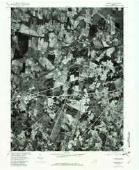
1977 Map of Gainesville
USGS Topo · Published 1977About this map
Gainesville and Manassas anchor this 1977 orthophotoquad, which uses rectified aerial photography to provide a clear view of Prince William County before the era of intensive suburban sprawl. The landscape is a patchwork of agricultural fields and woodlands, carved through by the drainage systems of Bull Run and Broad Run. Small crossroads settlements like Catharpin and Sudley Springs appear much as they did in previous decades, showing the slow pace of development in the northern portion of the quadrangle. South of Groveton, the emergence of larger transportation corridors and clearing for development near Wellington hints at the coming transformation of the region. This document was produced by the Geological Survey in cooperation with the Soil Conservation Service, utilizing photoimagery taken on March 16, 1977.
Find a feature on this map
8 named features on this map. Tap any name to fly to it.
Don’t see what you’re looking for? This feature index may not catch every label — zoom into the map to look around manually.
Map Details
Editions of this 1977 Gainesville Map
This is the sole edition of this map. No revisions or reprints were ever made.
Other maps of this area

1890 · Mt. Vernon
USGS Topo · 1:125,000

1891 · Mt. Vernon
USGS Topo · 1:125,000

1894 · Warrenton
USGS Topo · 1:125,000

1894 · Mt. Vernon
USGS Topo · 1:125,000

1897 · Mt. Vernon
USGS Topo · 1:125,000

1915 · Fairfax
USGS Topo · 1:62,500

1927 · Quantico
USGS Topo · 1:62,500

1933 · Middleburg
USGS Topo · 1:62,500

1940 · Quantico
USGS Topo · 1:62,500

1943 · Quantico
USGS Topo · 1:62,500