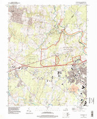
1994 Map of Gainesville
USGS Topo · Published 1998About this map
Manassas National Battlefield Park dominates the landscape of Prince William County, preserving the site of historic conflict along Bull Run. The map detail highlights the preserved terrain including Matthews Hill and Buck Hill, along with memorial sites like the Groveton Confederate Cem and Stonewall Memory Gardens. The surrounding area shows a mixture of mid-century residential growth and preserved natural space, notably the Conway-Robinson Memorial State Forest.
Find a feature on this map
44 named features on this map. Tap any name to fly to it.
Don’t see what you’re looking for? This feature index may not catch every label — zoom into the map to look around manually.
Map Details
Editions of this 1994 Gainesville Map
This is the sole edition of this map. No revisions or reprints were ever made.
Other maps of this area

1890 · Mt. Vernon
USGS Topo · 1:125,000

1891 · Mt. Vernon
USGS Topo · 1:125,000

1894 · Warrenton
USGS Topo · 1:125,000

1894 · Mt. Vernon
USGS Topo · 1:125,000

1897 · Mt. Vernon
USGS Topo · 1:125,000

1915 · Fairfax
USGS Topo · 1:62,500

1927 · Quantico
USGS Topo · 1:62,500

1933 · Middleburg
USGS Topo · 1:62,500

1940 · Quantico
USGS Topo · 1:62,500

1943 · Quantico
USGS Topo · 1:62,500