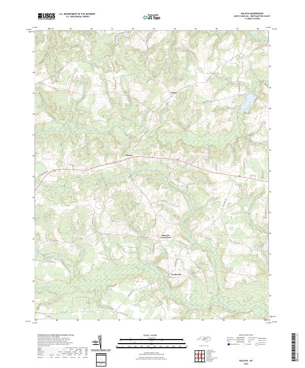
2022 Map of Galatia
USGS Topo · Published 2022About this map
Galatia and Creeksville anchor this rural landscape in Northampton County, defined by an intricate network of wetlands and creek systems. The drainage patterns of Rogers Swamp and Corduroy Swamp to the north, along with the meandering Potecasi Cr to the south, illustrate the low-lying coastal plain topography that has shaped local agriculture and road placement for generations. Small agrarian hubs like Edwards Crossroads and Faisons are connected by a web of local routes, including several named for long-standing community landmarks such as Sharron Church Rd and Zion Church Rd.
Find a feature on this map
38 named features on this map. Tap any name to fly to it.
Don’t see what you’re looking for? This feature index may not catch every label — zoom into the map to look around manually.
Map Details
Editions of this 2022 Galatia Map
This is the sole edition of this map. No revisions or reprints were ever made.
Other maps of this area

1919 · Boykins
USGS Topo · 1:48,000

1919 · Arringdale
USGS Topo · 1:48,000

1920 · Boykins
USGS Topo · 1:62,500

1920 · Arringdale
USGS Topo · 1:62,500

1942 · Arringdale
USGS Topo · 1:62,500

1953 · Norfolk
USGS Topo · 1:250,000

1966 · Margarettsville
USGS Topo · 1:24,000
1966 · Claresville
USGS Topo · 1:24,000
1966 · Boykins
USGS Topo · 1:24,000
1973 · Conway
USGS Topo · 1:24,000