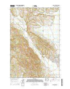
2014 Map of Gales Creek
USGS Topo · Published 2014About this map
Gales Creek and its surrounding rural communities define the landscape of this northwest Oregon region. The map highlights a network of agricultural and timbered lands north of Forest Grove, where water management is central to the local economy. A high concentration of irrigation and storage features like the Howell Reservoirs, Heesacker Reservoir, and Maple Headquarters Reservoir illustrate the area's intensive land use. For genealogists, the map is particularly rich with burial sites, including the Forest View Cem, Gales Creek Cem, and Purdin Cem.
Find a feature on this map
166 named features on this map. Tap any name to fly to it.
Don’t see what you’re looking for? This feature index may not catch every label — zoom into the map to look around manually.
Map Details
Editions of this 2014 Gales Creek Map
This is the sole edition of this map. No revisions or reprints were ever made.
Other maps of this area

1941 · Timber
USGS Topo · 1:62,500

1941 · Gales Creek
USGS Topo · 1:62,500

1941 · Yamhill
USGS Topo · 1:62,500

1942 · Yamhill
USGS Topo · 1:62,500

1942 · Fairdale
USGS Topo · 1:62,500

1948 · Vancouver
USGS Topo · 1:250,000

1950 · Vancouver
USGS Topo · 1:250,000

1950 · Vancouver
USGS Topo · 1:250,000

1955 · Timber
USGS Topo · 1:62,500

1955 · Fairdale
USGS Topo · 1:62,500