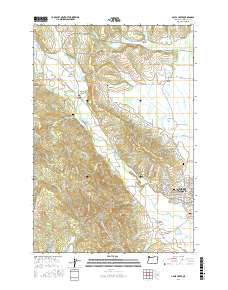
2017 Map of Gales Creek
USGS Topo · Published 2017About this map
Forest Grove serves as the eastern anchor of this 2017 survey, where the urban grid meets the agricultural and forest lands of the Tualatin Valley. The landscape is defined by the winding course of Gales Creek, which flows through small settlements like Balm Grove, Watts, and the namesake village of Gales Creek. To the north, the small community of Kansas City and the hillside hamlet of Hillside reflect the area’s long-standing rural character. Numerous family and community burial grounds, including Purdin Cem, Hillside Cem, and Gales Creek Cem, are preserved across the terrain, offering significant points of interest for genealogists tracing local lineage. The map also captures a complex water management system of reservoirs and wetlands, such as Killin Wetlands and the Lousignont Canal, highlighting the region's adaptation to the local hydrology between Gales Peak and the valley floor.
Find a feature on this map
126 named features on this map. Tap any name to fly to it.
Don’t see what you’re looking for? This feature index may not catch every label — zoom into the map to look around manually.
Map Details
Editions of this 2017 Gales Creek Map
This is the sole edition of this map. No revisions or reprints were ever made.
Other maps of this area

1941 · Timber
USGS Topo · 1:62,500

1941 · Gales Creek
USGS Topo · 1:62,500

1941 · Yamhill
USGS Topo · 1:62,500

1942 · Yamhill
USGS Topo · 1:62,500

1942 · Fairdale
USGS Topo · 1:62,500

1948 · Vancouver
USGS Topo · 1:250,000

1950 · Vancouver
USGS Topo · 1:250,000

1950 · Vancouver
USGS Topo · 1:250,000

1955 · Timber
USGS Topo · 1:62,500

1955 · Fairdale
USGS Topo · 1:62,500