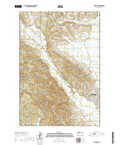
2020 Map of Gales Creek
USGS Topo · Published 2020About this map
Forest Grove sits at the edge of the Tualatin Valley, where the landscape transitions from the flat valley floor to the rising timberlands of the Coast Range. This area is defined by the drainage of Gales Creek, which flows southeast past settlements like Balm Grove and Watts. The region’s agricultural and residential development is evidenced by numerous small water management features, including the Lousignont Canal, Pecks Pond, and several family-named reservoirs like Heesacker Reservoir and Jackson Reservoir.
Find a feature on this map
132 named features on this map. Tap any name to fly to it.
Don’t see what you’re looking for? This feature index may not catch every label — zoom into the map to look around manually.
Map Details
Editions of this 2020 Gales Creek Map
This is the sole edition of this map. No revisions or reprints were ever made.
Other maps of this area

1941 · Timber
USGS Topo · 1:62,500

1941 · Gales Creek
USGS Topo · 1:62,500

1941 · Yamhill
USGS Topo · 1:62,500

1942 · Yamhill
USGS Topo · 1:62,500

1942 · Fairdale
USGS Topo · 1:62,500

1948 · Vancouver
USGS Topo · 1:250,000

1950 · Vancouver
USGS Topo · 1:250,000

1950 · Vancouver
USGS Topo · 1:250,000

1955 · Timber
USGS Topo · 1:62,500

1955 · Fairdale
USGS Topo · 1:62,500