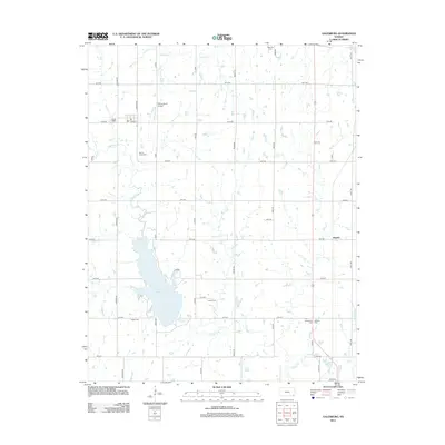
2012 Map of Galesburg
USGS Topo · Published 2012About this map
Lake Parsons dominates the central landscape of this Neosho and Labette County border region, serving as a primary hydrological and recreational landmark north of the city of Parsons. The surrounding terrain is defined by a grid of rural roads and the winding courses of Labette Cr and Ogeese Cr. The settlement of Hayden appears to the east, while a network of family and community burial sites such as Ladore Cem, Valley Cem, and Brethren Cem provides critical points of interest for genealogical research and local history. Transportation infrastructure is represented by the White Farms Airport and a small Po at the western edge of the quadrangle. The map captures a well-established agricultural landscape, where the naming of nearly every township road—from Meade Rd to Jackson Rd—reflects the systematic parceling and long-term residency characteristic of southeastern Kansas.
Find a feature on this map
39 named features on this map. Tap any name to fly to it.
Don’t see what you’re looking for? This feature index may not catch every label — zoom into the map to look around manually.
Map Details
Editions of this 2012 Galesburg Map
This is the sole edition of this map. No revisions or reprints were ever made.
Other maps of this area

1886 · Iola
USGS Topo · 1:125,000

1886 · Parsons
USGS Topo · 1:125,000

1893 · Iola
USGS Topo · 1:125,000

1893 · Parsons
USGS Topo · 1:125,000

1904 · Iola
USGS Topo · 1:125,000

1943 · McCune
USGS Topo · 1:62,500

1945 · Mc Cune
USGS Topo · 1:62,500

1945 · Parsons
USGS Topo · 1:62,500

1946 · Parsons
USGS Topo · 1:62,500

1947 · Parsons
USGS Topo · 1:62,500