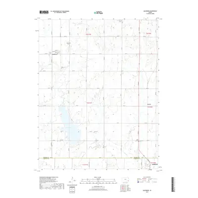
2018 Map of Galesburg
USGS Topo · Published 2018About this map
Galesburg serves as the primary settlement hub in this 2018 survey, which captures the rural transition where Neosho and Labette counties meet. The landscape is defined by the significant waters of Lake Parsons, which dominates the southwestern portion of the map and is fed by the meandering courses of Labette Cr. A grid of section roads, including Jackson Rd and 80th Rd, organizes the agricultural terrain, while smaller residential streets like Walnut St and Main St cluster within the town center. Local history is deeply embedded in the land through a high density of rural burial sites, such as Mount Hope Cem and Ladore Cem, which serve as vital markers for genealogical research. The presence of White Farms Airport north of town reflects the integration of private aviation into the region's traditional farming economy.
Find a feature on this map
44 named features on this map. Tap any name to fly to it.
Don’t see what you’re looking for? This feature index may not catch every label — zoom into the map to look around manually.
Map Details
Editions of this 2018 Galesburg Map
This is the sole edition of this map. No revisions or reprints were ever made.
Other maps of this area

1886 · Iola
USGS Topo · 1:125,000

1886 · Parsons
USGS Topo · 1:125,000

1893 · Iola
USGS Topo · 1:125,000

1893 · Parsons
USGS Topo · 1:125,000

1904 · Iola
USGS Topo · 1:125,000

1943 · McCune
USGS Topo · 1:62,500

1945 · Mc Cune
USGS Topo · 1:62,500

1945 · Parsons
USGS Topo · 1:62,500

1946 · Parsons
USGS Topo · 1:62,500

1947 · Parsons
USGS Topo · 1:62,500