2022 Map of Galesburg
USGS Topo · Published 2022About this map
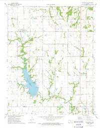
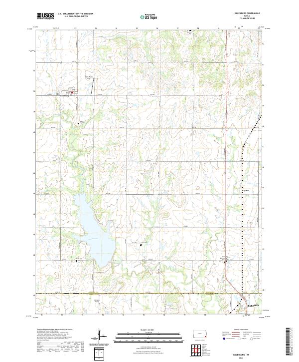
Galesburg and the surrounding prairie of the Neosho and Labette County border appear here in a landscape defined by an orderly grid of section-line roads and the winding course of Labette Creek. This area of Southeast Kansas maintains its agricultural character, evidenced by small private airstrips like White Farms Airport and Clemens Airport. The survey details the western reaches of Lake Parsons, a significant water body that influences the local topography near the southern edge of the sheet.
Find a feature on this map
46 named features on this map. Tap any name to fly to it.
Don’t see what you’re looking for? This feature index may not catch every label — zoom into the map to look around manually.
Map Details
Editions of this 2022 Galesburg Map
This is the sole edition of this map. No revisions or reprints were ever made.