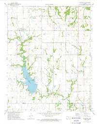
1973 Map of Galesburg
USGS Topo · Published 1975About this map
Galesburg stands as a primary railroad community in this early 1970s survey, situated along the Missouri-Kansas-Texas line. The landscape is defined by the significant reservoir of Lake Parsons, where numerous Campground facilities and Picnic Areas highlight the area's development for recreation. The map meticulously records the rural heritage of the border between Neosho and Labette Counties, preserving the locations of numerous family and community burial grounds such as Mt Hope Cem, Ladore Cem, and Brethren Cem.
Find a feature on this map
29 named features on this map. Tap any name to fly to it.
Don’t see what you’re looking for? This feature index may not catch every label — zoom into the map to look around manually.
Map Details
Editions of this 1973 Galesburg Map
This is the sole edition of this map. No revisions or reprints were ever made.
Other maps of this area

1886 · Iola
USGS Topo · 1:125,000

1886 · Parsons
USGS Topo · 1:125,000

1893 · Iola
USGS Topo · 1:125,000

1893 · Parsons
USGS Topo · 1:125,000

1904 · Iola
USGS Topo · 1:125,000

1943 · McCune
USGS Topo · 1:62,500

1945 · Mc Cune
USGS Topo · 1:62,500

1945 · Parsons
USGS Topo · 1:62,500

1946 · Parsons
USGS Topo · 1:62,500

1947 · Parsons
USGS Topo · 1:62,500