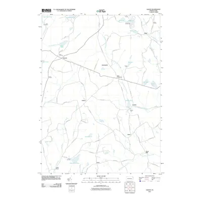
2010 Map of Galilee
USGS Topo · Published 2010About this map
Galilee and its surrounding hamlets in Wayne County define this rural landscape, where a complex network of brooks and branches feeds numerous named ponds and lakes. Early 21st-century infrastructure follows historic patterns, with roads like the Oregon Tpke and Calkins Rd connecting scattered settlements such as West Damascus, Rileyville, and Boyds Mills. The mapping of small-scale dams, including the Miller Pond Dam and Lovelass Dam, underscores the historical and ongoing importance of water management in the region's localized economy. Genealogists can locate family-named landmarks such as the Bolkcom Cemetery and Hillcrest Cemetery, while the presence of Camp Chicopee reflects the area's legacy as a site for seasonal recreation and community gathering amidst the headwaters of South Branch Calkins Creek and North Branch Calkins Creek.
Find a feature on this map
83 named features on this map. Tap any name to fly to it.
Don’t see what you’re looking for? This feature index may not catch every label — zoom into the map to look around manually.
Map Details
Editions of this 2010 Galilee Map
This is the sole edition of this map. No revisions or reprints were ever made.
Other maps of this area

1892 · Honesdale
USGS Topo · 1:62,500

1920 · Long Eddy
USGS Topo · 1:62,500

1920 · Damascus
USGS Topo · 1:62,500

1921 · Long Eddy
USGS Topo · 1:48,000

1923 · Damascus
USGS Topo · 1:62,500

1923 · Long Eddy
USGS Topo · 1:62,500

1926 · Starrucca
USGS Topo · 1:62,500

1930 · Starrucca
USGS Topo · 1:48,000

1933 · Starrucca
USGS Topo · 1:62,500

1943 · Honesdale
USGS Topo · 1:125,000