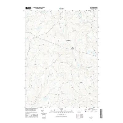
2016 Map of Galilee
USGS Topo · Published 2016About this map
Galilee and the surrounding townships of northeastern Pennsylvania are defined by a network of small upland settlements and abundant glacial water bodies. This 2016 survey highlights the persistent rural character of Wayne County, where hamlets like Rileyville, Girdland, and Boyds Mills are connected by historically significant routes such as the Oregon Tpke. The landscape is dotted with several prominent ponds and lakes, including Duck Harbor Pond, Silver Lake, and Beaver Lake, illustrating a terrain where water management and recreation have long shaped local land use. Genealogists will find value in the specific placement of the Bolkcom Cem and Hillcrest Cem, while the inclusion of unique geographical markers like Butternut Flats along the S Br Calkins Cr provides a detailed look at the localized naming conventions used by generations of residents.
Find a feature on this map
76 named features on this map. Tap any name to fly to it.
Don’t see what you’re looking for? This feature index may not catch every label — zoom into the map to look around manually.
Map Details
Editions of this 2016 Galilee Map
This is the sole edition of this map. No revisions or reprints were ever made.
Other maps of this area

1892 · Honesdale
USGS Topo · 1:62,500

1920 · Long Eddy
USGS Topo · 1:62,500

1920 · Damascus
USGS Topo · 1:62,500

1921 · Long Eddy
USGS Topo · 1:48,000

1923 · Damascus
USGS Topo · 1:62,500

1923 · Long Eddy
USGS Topo · 1:62,500

1926 · Starrucca
USGS Topo · 1:62,500

1930 · Starrucca
USGS Topo · 1:48,000

1933 · Starrucca
USGS Topo · 1:62,500

1943 · Honesdale
USGS Topo · 1:125,000