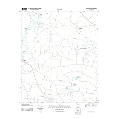
2011 Map of Galivants Ferry
USGS Topo · Published 2011About this map
The Little Pee Dee River and its complex network of oxbow lakes and wetlands define this portion of Horry County. At the river's crossing point, the historic settlement of Galivants Ferry remains a central landmark, connected by the Galivants Ferry Bridge to the western bank. The landscape is characterized by a high density of small, named water bodies such as Jack Lake, Cypress Lake, and Snowbird Lake, which sit alongside distinctive terrain features like the Half Moon Sand Hills and Bear Knot Island.
Find a feature on this map
126 named features on this map. Tap any name to fly to it.
Don’t see what you’re looking for? This feature index may not catch every label — zoom into the map to look around manually.
Map Details
Editions of this 2011 Galivants Ferry Map
This is the sole edition of this map. No revisions or reprints were ever made.
Other maps of this area

1943 · Adrian
USGS Topo · 1:24,000

1943 · Horry
USGS Topo · 1:24,000

1944 · Adrian
USGS Topo · 1:31,680

1946 · Johnsonville
USGS Topo · 1:62,500

1946 · Mullins
USGS Topo · 1:24,000

1947 · Centenary
USGS Topo · 1:24,000

1947 · Mullins
USGS Topo · 1:24,000

1948 · Galivants Ferry
USGS Topo · 1:24,000

1948 · Nichols
USGS Topo · 1:24,000

1948 · Bayboro
USGS Topo · 1:24,000