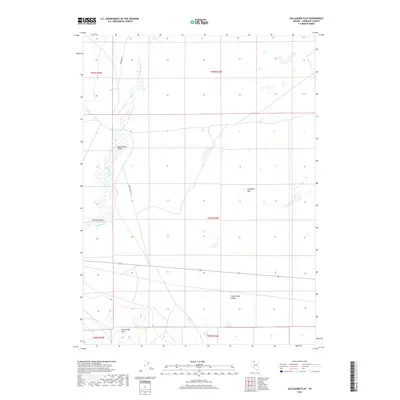
2018 Map of Gallagher Flat
USGS Topo · Published 2018About this map
The Quinn River meanders through this remote portion of Humboldt County, defining the hydrology of the Quinn River Valley as it appeared in 2018. The landscape is characterized by its wide, open basins, including the namesake Gallagher Flat and the expansive Silver State Valley to the south. In the southwestern corner, the northern reaches of the Slumbering Hills rise above the basin floor, providing the only significant topographic relief on the sheet. Human activity is marked primarily by ranching infrastructure and isolated desert routes, with River Ranch Rd and Riverside Rd providing access across the sagebrush-covered plains. This survey documents a critical drainage point in the Great Basin where seasonal water flow and vast alkaline flats dictate the local geography.
Find a feature on this map
1 named feature on this map. Tap any name to fly to it.
Don’t see what you’re looking for? This feature index may not catch every label — zoom into the map to look around manually.
Map Details
Editions of this 2018 Gallagher Flat Map
This is the sole edition of this map. No revisions or reprints were ever made.
Other maps of this area

1882 · Paradise
USGS Topo · 1:250,000

1886 · Disaster
USGS Topo · 1:250,000

1893 · Paradise
USGS Topo · 1:250,000

1893 · Disaster
USGS Topo · 1:250,000

1954 · Vya
USGS Topo · 1:250,000

1955 · McDermitt
USGS Topo · 1:250,000

1958 · Vya
USGS Topo · 1:250,000

1958 · Awakening Peak
USGS Topo · 1:62,500

1959 · McDermitt
USGS Topo · 1:250,000

1959 · Orovada
USGS Topo · 1:62,500