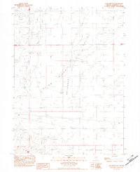
1982 Map of Gallagher Flat
USGS Topo · Published 1982About this map
The Quinn River meanders through this arid landscape in the early 1980s, carving a path through the expansive Gallagher Flat and into the Silver State Valley. This provisional study highlights the vital importance of water management in the Great Basin, evidenced by the distribution of named wells and windmills across the terrain. Remnants of human presence are scattered along the riverbank and basin floor, most notably at Domingo Cabin and River Ranch, sites that suggest a history of seasonal ranching or long-term habitation. The terrain is largely defined by numerous Alkali Flats, emphasizing the high evaporation rates and mineral-rich soils characteristic of this Nevada basin. This map serves as a detailed record of remote infrastructure, including the Single Wood Pole Power Line and isolated points like Little Windmill and Hanks Well.
Find a feature on this map
16 named features on this map. Tap any name to fly to it.
Don’t see what you’re looking for? This feature index may not catch every label — zoom into the map to look around manually.
Map Details
Editions of this 1982 Gallagher Flat Map
This is the sole edition of this map. No revisions or reprints were ever made.
Other maps of this area

1882 · Paradise
USGS Topo · 1:250,000

1886 · Disaster
USGS Topo · 1:250,000

1893 · Paradise
USGS Topo · 1:250,000

1893 · Disaster
USGS Topo · 1:250,000

1954 · Vya
USGS Topo · 1:250,000

1955 · McDermitt
USGS Topo · 1:250,000

1958 · Vya
USGS Topo · 1:250,000

1958 · Awakening Peak
USGS Topo · 1:62,500

1959 · McDermitt
USGS Topo · 1:250,000

1959 · Orovada
USGS Topo · 1:62,500