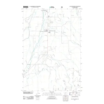
2011 Map of Gallatin Gateway
USGS Topo · Published 2011About this map
The Gallatin River valley defines the character of this Montana landscape, where the settlement of Gallatin Gateway serves as a central hub for the surrounding ranching and residential land. The map reveals a complex network of water management essential to the region, including the Farmers Canal, Elk Grove Slough, and Safely Ditch, which crisscross the valley floor. Near the river, community landmarks like the Gallatin Gateway Post Office and the Gallatin Gateway Rural Fire Dist anchor the local geography, while the Gallatin Gateway Cemetery and Gallatin Gateway Inn Park provide focal points for local history researchers.
Find a feature on this map
75 named features on this map. Tap any name to fly to it.
Don’t see what you’re looking for? This feature index may not catch every label — zoom into the map to look around manually.
Map Details
Editions of this 2011 Gallatin Gateway Map
This is the sole edition of this map. No revisions or reprints were ever made.
Other maps of this area

1888 · Three Forks
USGS Topo · 1:250,000

1894 · Three Forks
USGS Topo · 1:250,000

1895 · Three Forks
USGS Topo · 1:250,000

1947 · Bozeman
USGS Topo · 1:250,000

1948 · Bozeman
USGS Topo · 1:250,000

1949 · Anceney
USGS Topo · 1:62,500

1950 · Spanish Peaks
USGS Topo · 1:62,500

1953 · Bozeman
USGS Topo · 1:62,500

1955 · Bozeman
USGS Topo · 1:250,000

1955 · Garnet Mountain
USGS Topo · 1:62,500