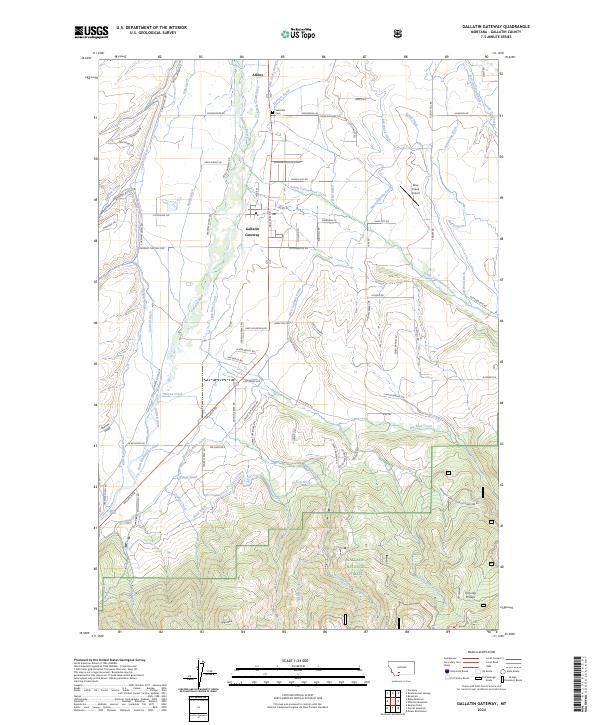
2024 Map of Gallatin Gateway
USGS Topo · Published 2024About this map
Gallatin Gateway serves as the focal point of this Montana landscape, where the Gallatin River and an intricate network of irrigation ditches define the valley's character. The legacy of the former town of Salesville is preserved through the Salesville Cem and the settlement's original name, while contemporary land use is marked by proximity to the Gallatin National Forest to the south. This area illustrates the transition from river-fed agricultural plains to rising mountainous terrain, evidenced by features like Tom Lay Prairie and Ruby Mountain RD. The hydraulic engineering of the region is notably dense, with the Farmers Canal, West Gallatin Canal, and Highline Canal cutting through the landscape to support the high-altitude ranching and farming operations between Atkins and the forest boundary.
Find a feature on this map
97 named features on this map. Tap any name to fly to it.
Don’t see what you’re looking for? This feature index may not catch every label — zoom into the map to look around manually.
Map Details
Editions of this 2024 Gallatin Gateway Map
This is the sole edition of this map. No revisions or reprints were ever made.
Other maps of this area

1888 · Three Forks
USGS Topo · 1:250,000

1894 · Three Forks
USGS Topo · 1:250,000

1895 · Three Forks
USGS Topo · 1:250,000

1947 · Bozeman
USGS Topo · 1:250,000

1948 · Bozeman
USGS Topo · 1:250,000

1949 · Anceney
USGS Topo · 1:62,500

1950 · Spanish Peaks
USGS Topo · 1:62,500

1953 · Bozeman
USGS Topo · 1:62,500

1955 · Bozeman
USGS Topo · 1:250,000

1955 · Garnet Mountain
USGS Topo · 1:62,500