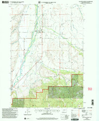
2000 Map of Gallatin Gateway
USGS Topo · Published 2005About this map
The Gallatin River valley serves as a focal point for this turn-of-the-millennium survey, dominated by a sophisticated network of early irrigation infrastructure. The settlement of Gallatin Gateway sits at the heart of a landscape defined by water rights and agricultural engineering, where legacy systems like the Farmers Canal, West Gallatin Canal, and numerous family-named waterways such as Etherington Ditch and Allison Ditch cross the plains. To the north and south, landmarks like Axtell Bridge and Williams Bridge provide vital crossings over the main river channel.
Find a feature on this map
43 named features on this map. Tap any name to fly to it.
Don’t see what you’re looking for? This feature index may not catch every label — zoom into the map to look around manually.
Map Details
Editions of this 2000 Gallatin Gateway Map
This is the sole edition of this map. No revisions or reprints were ever made.
Other maps of this area

1888 · Three Forks
USGS Topo · 1:250,000

1894 · Three Forks
USGS Topo · 1:250,000

1895 · Three Forks
USGS Topo · 1:250,000

1947 · Bozeman
USGS Topo · 1:250,000

1948 · Bozeman
USGS Topo · 1:250,000

1949 · Anceney
USGS Topo · 1:62,500

1950 · Spanish Peaks
USGS Topo · 1:62,500

1953 · Bozeman
USGS Topo · 1:62,500

1955 · Bozeman
USGS Topo · 1:250,000

1955 · Garnet Mountain
USGS Topo · 1:62,500