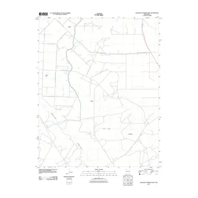
2010 Map of Gallegos Trading Post
USGS Topo · Published 2010About this map
Gallegos Trading Post sits as a notable landmark in this corner of the Eastern Navajo Agency, a landscape defined by its network of Indian Service Routes and vital water sources. The map captures an arid environment where ranching and local commerce depend on isolated water points like Gallegos Windmill, McKay Windmill, and the reliable Pete Spring. These features, along with the settlement of Huerfano, are connected by a grid of specialized roads such as Indian Service Route 3003 and Indian Service Route 4022.
Find a feature on this map
15 named features on this map. Tap any name to fly to it.
Don’t see what you’re looking for? This feature index may not catch every label — zoom into the map to look around manually.
Map Details
Editions of this 2010 Gallegos Trading Post Map
This is the sole edition of this map. No revisions or reprints were ever made.
Other maps of this area

1889 · Largo
USGS Topo · 1:250,000

1889 · Chaco
USGS Topo · 1:250,000

1892 · Chaco
USGS Topo · 1:250,000

1895 · Largo
USGS Topo · 1:250,000

1954 · Shiprock
USGS Topo · 1:250,000

1954 · Aztec
USGS Topo · 1:250,000

1958 · Shiprock
USGS Topo · 1:250,000

1958 · Aztec
USGS Topo · 1:250,000

1959 · Shiprock
USGS Topo · 1:250,000

1960 · Bloomfield
USGS Topo · 1:62,500
Featured Places
- Eastern Navajo Agency, NM
- Teeł Sikaad, Eastern Navajo Agency
- Huerfano, Eastern Navajo Agency
- San Juan County, NM
- United States