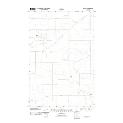
2011 Map of Gallup City
USGS Topo · Published 2011About this map
The extraction landscape of Gallup City defines this portion of Pondera County, where the road network reveals the region's industrial heritage. Named routes like Black Gold Rd, Oil Field Rd, and the Pondera Oil Fld underscore the historical importance of petroleum development to this Montana prairie. This specialized infrastructure is overlaid upon a rugged drainage system of coulees, including Aldrich Coulee, Farmers Coulee, and Maucki Coulee. While the township structure is strictly gridded by section lines and local lanes like 6th Ln NW, the natural hydrology persists through essential water sources such as Aldrich Spring and Noble Spring. The map documents a sparsely populated but working landscape where the intersection of Pendroy Rd and Gallup City Rd serves as a primary navigation point for the surrounding fields.
Find a feature on this map
26 named features on this map. Tap any name to fly to it.
Don’t see what you’re looking for? This feature index may not catch every label — zoom into the map to look around manually.
Map Details
Editions of this 2011 Gallup City Map
This is the sole edition of this map. No revisions or reprints were ever made.
Other maps of this area

1886 · Great Falls
USGS Topo · 1:250,000

1920 · Choteau
USGS Topo · 1:125,000

1920 · Dupuyer
USGS Topo · 1:125,000

1920 · Conrad
USGS Topo · 1:125,000

1938 · Gallup City
USGS Topo · 1:62,500

1942 · Gallup City
USGS Topo · 1:62,500

1950 · Collins
USGS Topo · 1:62,500

1954 · Great Falls
USGS Topo · 1:250,000

1954 · Shelby
USGS Topo · 1:250,000

1955 · Choteau
USGS Topo · 1:250,000