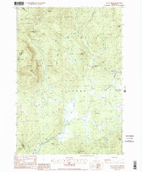
1988 Map of Gallup Mills
USGS Topo · Published 1988About this map
Victory State Forest and the surrounding timberlands of Essex County dominate this late 20th-century landscape, reflecting a region defined by conservation and historical industry. The map documents the remnants of the local timber economy at Moccasin Mill (Site) near Gallup Mills, a small settlement positioned at the confluence of several mountain brooks. These waterways, including Moose Brook and Lund Brook, carve through a terrain marked by peaks such as East Haven Mountain and Umpire Mtn. In the southern reaches, the Victory settlement and a local Gaging Station sit along the river, while the small village of Granby occupies the eastern slopes. This survey captures a specific moment in Vermont's Northeast Kingdom, balancing the preservation of Darling State Forest Park with localized extraction at sites like the Gravel Pit.
Find a feature on this map
45 named features on this map. Tap any name to fly to it.
Don’t see what you’re looking for? This feature index may not catch every label — zoom into the map to look around manually.
Map Details
Editions of this 1988 Gallup Mills Map
2 editions found
Other maps of this area

1900 · Whitefield
USGS Topo · 1:62,500

1920 · Guildhall
USGS Topo · 1:62,500

1931 · Guildhall
USGS Topo · 1:48,000

1931 · Littleton
USGS Topo · 1:62,500

1932 · Littleton
USGS Topo · 1:48,000

1933 · Guildhall
USGS Topo · 1:48,000

1935 · Littleton
USGS Topo · 1:62,500

1935 · Whitefield
USGS Topo · 1:48,000

1937 · Guildhall
USGS Topo · 1:62,500

1938 · Whitefield
USGS Topo · 1:62,500