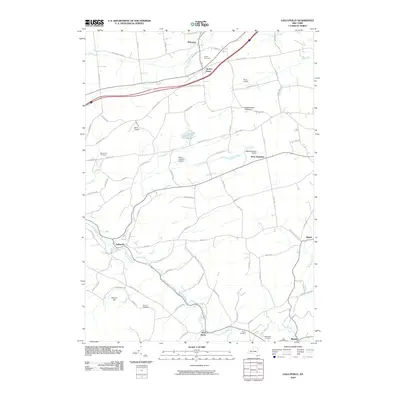
2010 Map of Gallupville
USGS Topo · Published 2010About this map
Quaker Street and Delanson anchor the northern reaches of this landscape, where the Normans Kill winds through a terrain defined by small aviation sites and ancestral burial grounds. The map captures a network of rural settlements including Gallupville and West Township, connected by a web of named roads like Schoharie Tpke and Barton Hill Rd. This area is particularly noteworthy for its concentration of private airfields, such as Wandervogel Gliderport and Boss Airport, suggesting a unique mid-to-late 20th-century aviation culture in this part of Schenectady and Albany Counties.
Find a feature on this map
86 named features on this map. Tap any name to fly to it.
Don’t see what you’re looking for? This feature index may not catch every label — zoom into the map to look around manually.
Map Details
Editions of this 2010 Gallupville Map
This is the sole edition of this map. No revisions or reprints were ever made.
Other maps of this area

1895 · Amsterdam
USGS Topo · 1:62,500

1896 · Fonda
USGS Topo · 1:62,500

1898 · Fonda
USGS Topo · 1:62,500

1898 · Schoharie
USGS Topo · 1:62,500

1900 · Schoharie
USGS Topo · 1:62,500

1900 · Schoharie
USGS Topo · 1:31,680

1900 · Berne
USGS Topo · 1:62,500

1902 · Fonda
USGS Topo · 1:62,500

1903 · Berne
USGS Topo · 1:62,500

1931 · Amsterdam
USGS Topo · 1:62,500