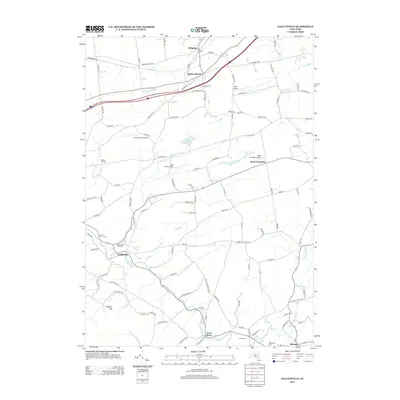
2013 Map of Gallupville
USGS Topo · Published 2013About this map
The Gallupville and Berne area of eastern New York presents a landscape shaped by historical settlements and the winding paths of rural creeks. This 2011 aerial-based survey highlights the transition between the rolling uplands of Zimmer Hill and the valley floors where Fox Cr and Ox Kill flow. The map is particularly useful for genealogical research, identifying several small burial grounds such as Gallupville Rural Cem, Barton Hill Cem, and the Woodlawn Cem near Berne. Small airstrips, including Apex Airport and Nettie's Place Airport, dot the landscape, suggesting a pattern of modern utility alongside historic hamlets. Transportation routes like the Schoharie Tpke and Gallupville Rd connect the larger villages to the more isolated agricultural and residential parcels of West Township and Quaker Street, while the Bozen Kill marks the northeastern terrain toward Delanson.
Find a feature on this map
108 named features on this map. Tap any name to fly to it.
Don’t see what you’re looking for? This feature index may not catch every label — zoom into the map to look around manually.
Map Details
Editions of this 2013 Gallupville Map
This is the sole edition of this map. No revisions or reprints were ever made.
Other maps of this area

1895 · Amsterdam
USGS Topo · 1:62,500

1896 · Fonda
USGS Topo · 1:62,500

1898 · Fonda
USGS Topo · 1:62,500

1898 · Schoharie
USGS Topo · 1:62,500

1900 · Schoharie
USGS Topo · 1:62,500

1900 · Schoharie
USGS Topo · 1:31,680

1900 · Berne
USGS Topo · 1:62,500

1902 · Fonda
USGS Topo · 1:62,500

1903 · Berne
USGS Topo · 1:62,500

1931 · Amsterdam
USGS Topo · 1:62,500