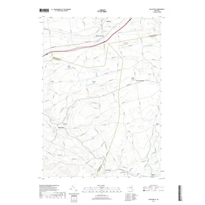
2019 Map of Gallupville
USGS Topo · Published 2019About this map
Quaker Street and Gallupville anchor a landscape defined by the intersection of three counties — Schenectady, Schoharie, and Albany. This region of New York is characterized by numerous small aviation strips such as Apex Airport, Blue Heron Airport, and Nettie's Place Airport, suggesting a modern rural landscape that maintains its private-pilot infrastructure. The hydrography is particularly notable, with the Normans Kill and Bozen Kill flowing in the north while Fox Creek winds through the southern terrain near Zimmer Hill. Genealogists will find a wealth of burial records across the quadrangle, from the Gallupville Rural Cem to the Berne and Beaverdam Cem and the small Barton Hill Cem. The presence of the CSX railroad corridor near Delanson indicates the continued importance of this historic transportation route for the village of Quaker Street.
Find a feature on this map
117 named features on this map. Tap any name to fly to it.
Don’t see what you’re looking for? This feature index may not catch every label — zoom into the map to look around manually.
Map Details
Editions of this 2019 Gallupville Map
This is the sole edition of this map. No revisions or reprints were ever made.
Other maps of this area

1895 · Amsterdam
USGS Topo · 1:62,500

1896 · Fonda
USGS Topo · 1:62,500

1898 · Fonda
USGS Topo · 1:62,500

1898 · Schoharie
USGS Topo · 1:62,500

1900 · Schoharie
USGS Topo · 1:62,500

1900 · Schoharie
USGS Topo · 1:31,680

1900 · Berne
USGS Topo · 1:62,500

1902 · Fonda
USGS Topo · 1:62,500

1903 · Berne
USGS Topo · 1:62,500

1931 · Amsterdam
USGS Topo · 1:62,500